|
Distance |
From Helmsley 22.3km / 13.8 miles |
|
|
Explorer maps |
North York Moors, Western Area OL26 |
|
|
Time |
6.5 - 7 hours average time based on Naismith’s rule |
|
| Total ascent |
549m |
|
| Total descent |
461m |
|
|
Waypoint coordinates |
|
|
| Download PDF |
|
|
|
Overview |
This is a pleasant path that starts at the centre of the medieval village of Helmsley. After leaving the village meander across fields to pass through the village of Pockley, then follow quiet country lanes before descending into the peaceful valley of Sleighholme Dale. Head east to reach Highfield Lane and then cross over the moor using Rudland Rigg. |
 1 - From the square continue ahead following the direction of the A170, direction Scarborough. Turn left on Carlton Road and then right onto the Bridleway to a telegraph pole and a path junction. Follow the footpath, direction Pockley following diversion round the farm.
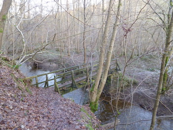
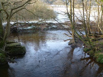
2 - Turn left onto Monks Gardens Lane briefly and then turn right to Riccall Woods. After passing through the gate turn right through the woods down to meet a wide track, T-junction. Turn left and then bear right down to a wooden bridge to cross the stream and then up the valley cutting to Cow Hill and Intake Lane.
3. At the road turn left through Pockley and after leaving the village turn right, direction Bedlam and then right again, direction Bedlam to a T-junction. At the T-junction turn left passing Nawton Tower Estate to a T-junction.
4. Turn left at the T-junction and at Wether Cote farm keep ahead into the field. After passing through the first field turn right, keeping the fence boundary on the right. At the corner of the field bear left down the hillside (can be slippy) to the gate. Pass through the gate and ahead to the second gate. Turn left to Sleighholme Farm.
 5. Follow the footpath sign into the field to pass the farm on the right. Continue through the next one and at the third field bear right to the far corner to cross the wooden bridge over the stream. Continue ahead with the boundary fence on the left, not through the gate, to the field corner and turn right to pick up the path. Bear left up the hillside and at the field bear right to cross a stile and then ahead to the farm and road.
6. Turn left on the lane and after passing a cattle grid sign on the right turn right onto the Bridleway. Keep the field boundary on the right and eventually reach a tarmac lane that goes left to Manor House, Private road. Keep ahead to the road and turn left onto Highfield Lane. After crossing the cattle grid, where the road bends left, keep ahead onto the road marked unsuitable for motors.
7. The path follows Rudland Rigg through the moors. At the path crossroads turn right and down the hill to a small lane. Turn right and the left at the road junction to Church Houses.