
|
Distance |
28.5 km / 17.1 miles |
|||
|
Explorer map |
224 Corby, Kettering & Wellingborough |
|||
|
Time |
6 - 6.5 hours average time based on Naismith’s rule |
|||
| Total ascent | 120m | |||
| Total descent | 194m | |||
|
Waypoint coordinates |
|
|||
| Download PDF |
|
|
||
|
Overview |
This is a long section if completed in full from Great Easton, but at the time of writing there was accommodation in Corby and Geddington to make this section shorter. The first field section was overgrown and difficult to pass through (I had to put waterproof trousers on to get through) and after passing the farm the path to the road was not easy to find. After that the way is easy to follow. The route passes through a number of Medieval Villages - Great Oakley, Geddington which contains what is thought to be the best surviving Eleanor cross erected by Edward I (1239–1307) to his late wife, Eleanor of Castile (1244–1290), Warkton Cranford St John, Great Addington and Irthlingborough Yrtlingaburg in the 8th century, it is called Erdiburn in the Domesday Book, later still, Artleborough. |
|||
1 - From reaching Pipewell Road bear right to take a footpath left into the field towards Lower Lodge Farm (May need waterproof trousers for extremely tall nettles, it was very difficult to cross at the time of writing the route). After passing the farm cross over the small bridge on the right into the field, bear left to the right corner at the end. Cross into small copse and right through hedge across the field to take the track in the far left hand corner. Cross the road and continue with the brook on your left, bear left to cross under the A6014 and continue with the beck on your right now. At the next road turn right crossing over stream and then immediately left with the beck on your left. Pass through the gate to Field Cottages and the t-junction. Turn right up the hill, then left up Woodlands Lane. to Great Oakley and the footpath at the end of the road.
 2 - In Great Oakley continue to the end of the road to the footpath ahead to then cross a road and underneath the railway line to reach a new motorway. Take the footpath diversion right and over the bypass. Then turn left into field to pick up the footpath again. Follow the footpath towards Geddington ignoring footpaths left and right. At the road turn left, and at the village sign turn right to Mill Farm, bridleway signed to Newton. Just after the far buildings on the left turn left down the track and straight on to the path that follows the back of the houses on the left, At the road turn right and then left to a footpath to reach the A43 main road. Cross over to the Porters Lodge and turn right following the Estate boundary wall and then left to Weekley.
3 - Walk through the the village. Turn left at the road and continue on the footpath directly ahead into field and the road to Warkton. At the road turn left and travel all the way through Warkton (cafe). Pass Warkton Lane on your right to the footpath on the road corner. Pass the left hand corner of the building to the middle of the field boundary ahead. Across the field to pass under the power lines with the hedge on your left. At the end of the field bear left into the next one and where the path meets a track junction turn right. After passing the second clump of trees on the right, turn left opposite The Grange farm to Top Dysons road and Cranford St Andrew.
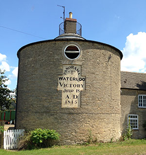
4 - Cranford St. Andrew (Old Forge Tea Room). Turn right at the road, then right at the t-junction and then left bridleway to follow the A14 with it on your left. In the field with a lorry trailer parked in it head to the right boundary fence and through the gate and right again to skirt round the old quarry which is now a Council Refuse site. Halfway along the other side turn right through the field and a further three fields to arrive at the Round House and the A510. Travel past the round house with it on your left and left through the farmyard left to follow the path to Great Addington.
5 - At Great Addington turn right, and right again down Woodford Road and through the village turning right along High street in Little Addington. Follow the road round left and up Chapel Hill. Cross the road to follow the Nene Way down to the river. Don’t cross the bridge, but turn right to follow the river to take the path past the adventure camp on your right. At the the lock bear right, along Marsh Lane this goes past Nene Park football stadium with it on your left to reach Irthlingborough.