
|
Distance |
26.7km / 16.50 miles |
|||
|
IGN map |
GR Top100 Map - 104 Reims Saint - Quentin |
|||
|
Time |
6.5 - 7 hours average time based on Naismith’s rule |
|||
| Total ascent | 319m | |||
| Total descent | 389m | |||
|
Waypoint coordinates |
|
|||
| Download PDF |
|
|||
|
Overview |
The route follows minor tracks, farm tracks, minor roads and woodland sections that can be very muddy. Walk on sections of the GR142 and the GR12A. |
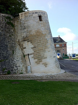
1 - With the Mairie behind you go straight ahead, turn right along Rue du Bourg keeping left at the next junction and bear left Rue St Martin. Continue ahead to pass the L’Abbaye de Saint Martin and after passing the city wall on your right turn left Sente des Valezys. Go down the hill and turn left at the road along Rue Romanette and then right down the small lane (road mirrors) Chemin de Semilly A Leuilly. Cross over the busy road and then right and first left Rue le Coq which will become Rue de la Ferme.
 2 - Turn left at the T-junction and then right on the gravel track to the woods. Bear left ignoring the track on the right along the edge of the field. The track through the woods is muddy and has lots of deep ruts due to wheeled vehicles travelling through. After 1km reach a road and turn left and then right back into the woods after passing a house on the right. After 1km bear left to reach the village of Vorges.
3 - In the centre of Vorges turn left Rue du Docteur Ganautt and then take 2nd exit at the rounda-bout D25 to Centre Ville. Keep right at the island (Place des Portes), then right onto the D25 and through the centre of Bruyeres-et-Montberault. After 400m go across the mini roundabout keeping left to pass house no 57 on the left and then first left Viveux Chemin de Reims. Keep straight ahead onto the grass track. Ignore the 1st left, but at the 2nd bear left onto a smaller track (GR marked) to walk by and between fields. Keep left at the next path junction to reach the village of Cheret.
4 - At the T-junction on the corner of Chemin des Romez turn right and continue out of the village up the hill and straight across the cross roads to the village of Bievres. Pass through Bievres keeping left on the D88 Chermizy Ailles. Follow the road direction Chermizy Ailles which will go up a long winding steep hill. Before the top, as the road bears right (small quarry on right) turn left onto the track that will cross the ridge of the hill. Pass a small Calvaire on the left, and continue on the main track to eventually reach a road. Turn right and then left at the stop sign to pass the Mairie. Bear right on the D19 Corbeny, and then bear left and left again to reach Corbeny centre by the church.