
|
Distance |
38.7km / 24 miles |
|||
|
IGN map |
GR Top100 Map - 110 Reims St-Dizier |
|||
|
Time |
9.5 - 10 hours average time based on Naismith’s rule |
|||
| Total ascent | 1339m | |||
| Total descent | 1026m | |||
|
Waypoint coordinates |
|
|||
| Download PDF |
|
|||
|
Overview |
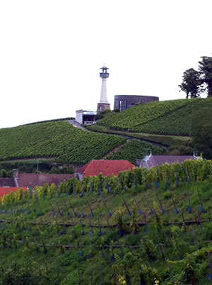
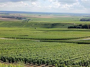
From the Cathedral the stage passes briefly through the town before returning to the canal to Sillery. Then pass through the Champagne vineyards and the woods of the Parc Naturel de la Montagne de Reims. There are sections that are strenuous with some steep climbs.
From Vezenay head back into the Foret de la Montagne de Reims, pass through vineyards and farmland before ending the day along the canal to Condé-sur-Marne. This stage is generally easy going. |
 1 - With Reims cathedral main doors behind you continue ahead along Rue Rockefeller, then left Rue Chanzy which leads onto Rue Gambetta. Follow the signs to and past the Basilica of Saint Remi.
2 - Turn right Rue Saint Julien to pass the Basilica on your right and then left into Rue Fery. Pass the building ahead on the right Rue Kalas, cross the roundabout and head to pass the Veuve Cliquout Ponsardin on your left - Rue Albert Thomas.
3 - At the end of Rue Albert Thomas cross over the canal and turn left to follow the tow path for 8km to the village of Sillery.
4 - At the Sillery marina turn right by the building, left Rue Canada, then right D308 Rue de Mailly to leave Sillery. Turn left in the hamlet of Le Poits and at the top of the hill turn right signed Verzenay 2km.
5 - Take the track left to pass the windmill across the road, then left at the crossroads, and then cross over the next track to the woods. Turn first left after leaving the woods down Avenue de Champagne to the square (Place de l’Europe).

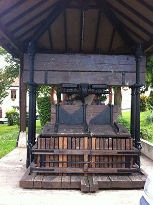
6 - From Place de l’Europe pass the wine vat on your left at the top of green, along Rue Frederic Bin, straight up the track, and then turn right signposted Verzy 2km. Bear left at the top and con-tinue straight across to pass between the vines into and out of the woods to then pass through a builders yard.
7 - Continue across the road and along Rue de La Croix de Mission, and through the woods, keep-ing straight ahead. After leaving the forest pass between grape vines again, continuing straight ahead and then across the road. Con-tinue between the vines (passing the line of trees on the right) and a wide track for 2.5km. At the road turn left,signed Billy-le-Grand 4km, then turn right (GR654).
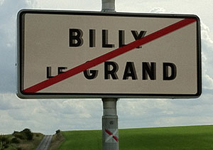
8 - Take the next right to follow the track around the grape vines. Cross over the track to continue downhill into the woods and then bear left after leaving them to pass between fields to reach a road to Billy-le-Grand. Pass through the village turning right before the Mairie, along Rue de Vaudemanges and then 2nd left Rue de la Voute.
 9 - The road will come to an end. Pass between trees with the canal on the right and then turn right along a grass track parallel with the canal on your right. At the end of the track reach a road, pass round the crash barriers, cross the road and turn right and left to continue along the track nearest the canal, signed Condé-sur-Marne 8km.
10 - At the canal lock turn left down the track and then the track right with trees either side, GR signed. Continue across the road onto the track and then turn right at the next track towards the trees to pass under pylon wires. Cross the canal bridge, turn left then right to follow the canal tow-path for 3.5km . Cross over the road in the village to re-join the towpath which bears right to a small road.  Continue along this, Rue de l’Embarcadere and then straight ahead between houses to arrive at Place Alexandre Batilliot in Condé-sur-Marne.