|
Distance |
27.9km / 17.50 miles |
|||
|
IGN map |
GR Top100 Map - 110 Reims St-Dizier |
|||
|
Time |
6.5 - 7 hours average time based on Naismith’s rule |
|||
| Total ascent | 310m | |||
| Total descent | 204m | |||
|
Waypoint coordinates |
|
|||
| Download PDF |
|
|
||
|
Overview |
This stage returns to the river, briefly on the road before continuing on a more direct and historically accurate route along what remains of the Roman Road. This is mostly off road ending at the Sigeric location of Fontaine-sur-Coole. There are no shops along these three stages and accommodation is very limited so plan ahead before leaving Châlons-en-Champagne.
There is an option to take the more tourist route that will add a full day and 48km on the journey towards Besancon. It will provide more shops and accommodation. Refer to the various guide books that are available for the details of that section. |
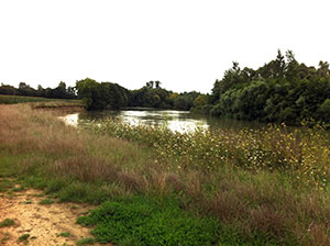 1 - From Rue Jean Jaurus turn left before the bridge over the river - Chemin Du Barrage, signed La-Chaussee-sur-Marne 24k. Bear slightly right to follow the path close to and parallel to the river. At the lock keep the river on your right and continue ahead to and along the track. After 1.5km the track will bear left. Pass between concrete blocks and then turn right along the path. This can be boggy and wet where vehicles have used it. Eventually the path will return to be alongside the river. After another 2.5km the path will open out into a field. Take the track left between fields heading towards the woods, river behind you.
 2. Take the first track right, GR mark on a concrete block on the ground / right. At the path junction keep left (GR mark) and continue ahead at the next junction to pass the wire gates on the right. After passing the metal gates on the right the path will bear left. Keep right at the next T-junction to reach a main road, then turn right to cross the bridge into the village.
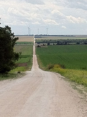
3. After passing the side of the church take the road right and follow it round left - signed Châlons-en-Champagne. Cross over the main road (D2) onto the gravel track for approx 2km. At the road turn right and then left to follow the Roman road for 6.5km.
4. After the last of the wind turbines on the left reach a road, D79. Turn right into the village, Fontaine-sur-Coole, and then left at the junction (D4) to Coole.