|
Distance |
21 km / 13 miles |
|
|
Explorer maps |
The Cheviot Hills, Jedburgh & Wooler OL 16 / Teviotdale South OS 333 | |
|
Time |
6.5 - 7 hours average time based on Naismith’s rule |
|
| Total ascent |
522m |
|
| Total descent |
515m |
|
|
Waypoint coordinates |
|
|
| Download PDF |
|
|
|
Overview |
This is a very pleasant and moderate walk. From Jedburgh Abbey the journey heads briefly up towards Dunion Hill before continuing below it through pleasant fields before ascending up to Black Law and down to Bedrule. Continue to Denholm and the possibility of visiting a cafe and down to the River Teviot which takes the walker to Hawick, albeit with a brief section on a country lane. |
 1 - With the abbey behind you turn left to walk back through the archway of the clock tower, turn left and left up Castlegate. At the front of the castle turn left up Galahill, across the ford and past Todlaw farm. Where the tarmac track turns left, keep right up a grassy, stony track passing under telephone wires
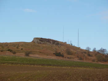
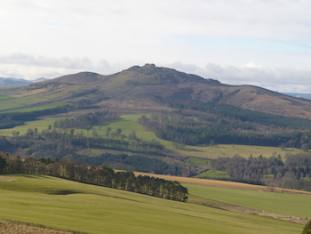
2 - Cross over Miller’s Burn and where the track bends right, turn left along the foot of Dunion Hill. Pass through Todlaw Wells Plantation. At the end of the second field bear right across the burn and up the hill towards the mast with a group of trees (Miller Dean) on the left.
3 - At the stone wall turn left and then right to cross the hillside diagonally left following the mark post. At the top descend the hillside keeping right of the trees (Blacklaw Strip) and down a narrow gulley to cross a stream. Continue diagonally left to the wall.
4 - Turn left with the wall on the right and then right to the road. At the memorial turn right, direction Denholm 2.5 miles. Cross over the bridge and then keep ahead at the junction, direction Denholme 2.5 miles.
 5 - Continue along the road to the T-junction and turn left, direction Towerburn and then the footpath left. At the end of the field bear left to cross Tower Burn and then right to then end of the next field. Turn left and after reaching the third field turn right through the trees keeping Denholm Mill wood on the left.
6 - The track bears left then turns right to Denholm and the Loaning to a T-junction. Turn left then right along Kirkside, past the Cream Puff cafe. The road bears right along Leydens Road to leave the village. After crossing the bridge over the River Teviot, turn left to continue along its banks to reach a tarmac lane. Turn left and continue along it and after passing a small low stone wall and a driveway on the right, turn left, direction Border Abbey’s Way. Continue along the banks of the river again.
7 - Continue ahead with the river on the left and an Industrial estate on the right and then the rugby / football club to a roundabout and the leisure centre on the right. Bear left keeping the river on the left on Mansfield road to the roundabout. Turn left along Mart street, crossing the river to the roundabout and then right onto Boutree Place and the main street in Hawick and the end of the stage.